Switching seasons
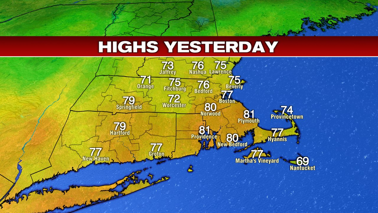
Yesterday was great wasn’t it? I mean even if you like the fall like weather (myself included in that), the random summer like days with the sunshine are hard to complain about. Temperatures yesterday were more typical of mid June. By Saturday, the temperatures will be more like mid November. Opening the door for that dramatic drop in temperatures is a cold front that will pass through on Friday. As it does, that storm system will touch of scattered showers through the day. It will not rain all day. In fact, I think the rain will come in two separate waves:
First, a period of on and off showers all morning long. They’ll get started around 6 am and last through noon. From there, we’ll dry out for a few hours before round two arrives later in the evening.
Second, a shorter-lived period of rain will move through in the evening. That could be heavier rain, but it doesn’t last as long. This second wave is the actual cold front passing through. Once that happens, temperatures will fall quickly into Saturday.
Here’s a radar snapshot of 7am. You can see the rain just moving into the area:
Once that passes we may thin the clouds a bit, but clouds will dominate through most of the day. Temperatures are mild though, thanks to a southerly breeze. Highs should climb to the mid and upper 60s, which is above the normal (now 62°).
Friday will be breezy through the day, but Saturday looks to take the cake for strong wind gusts. Wind gusts Friday are manageable, topping out 20-30 mph. That’s similar to what the wind gusts were early this morning if you were outside early today.
The showers will be spotty after that second wave Friday evening, but they will hang around for most of Friday night. The last of the showers may not clear until very early Saturday morning. This is approximately 6-7am Saturday. Most of the rain is gone, but a lingering shower may just be moving out of southeastern Massachusetts and the Cape.
Once that front passes, the wind will shift to the northwest and push in cooler temperatures for Saturday. Saturday is a day where I wouldn’t focus on the single temperature number (like on your app) for a few reasons.
First, Saturday will likely be a day with falling temperatures all night Friday night and early Saturday morning. So while low temperatures for a day are typically at sunrise, that won’t be the case Saturday. The actual high temperature for Saturday could be the mid and upper 50s, but that will be between midnight and 3 am, falling from there. So for most of the day, temperatures will be in the 40s to near 50°. Here’s a temperature snapshot at 2 pm Saturday.
Second, the gusty wind will make it feel cooler than this. Saturday midday will have wind gusts 25-35 mph. That will take temperatures in the upper 40s and slash off 5-8° for the feels like temperatures in the afternoon. Here’s a snapshot of wind gusts Saturday afternoon.
Saturday evening, after 6pm the wind gusts will shut down pretty quickly. But with clear skies, a cold air mass, and a significantly lighter wind, we’ll have a cold night Saturday night/early Sunday morning. A few towns have hit freezing this year — Bedford, the Vineyard (officially at the airport), and Nashua. More of us will hit the freezing mark by Sunday morning.
These are the approximate Sunday morning temperatures:
All of that behind us, Sunday ends up being a nice day. Chilly? Yes. But not as bad as Saturday. Temperatures will be a little warmer Sunday, but more importantly the wind will shut off and the skies will stay sunny. That makes these cooler temperatures much more manageable to be out in. So if you are planning any weekend fall activities, Sunday is your pick.
Sunday high temperatures:
The full article is being collected. Available text is shown for now.